About our bussines
Premer Savković was founded in Lazarevac in 2004. and the activity we deal with is geodetic work of all kinds.
Integrity
The company is licensed by the Republic Geodetic Authority with a work license and graduate geodetic engineers have design and performing licenses of the Serbian Chamber of Engineers.
Technology
Tendecy for improvement and constant innovation have never been a topic of debate, so today we have the latest technology and we offer modern engineering solutions to all your problems.
ISO STANDARDS
The organization PREMER SAVKOVIC LLC has been successfully operating for over four years as an LLC organization and a total of more than 20 years in the geodetic profession. As a serious company, we have decided to implement the most significant international standards in our operations, which will contribute to the highest quality service, environmental protection, and the health and safety of our employees.
We are a significant player in the geodetic services market, and our team consists of both experienced experts and young professionals who bring fresh perspectives to our collective. Our mission is to continue being significant players in the market in the coming period, to further expand activities abroad, and to respond with high-quality services that will be competitive with other organizations.
The following principles represent the foundation of our commitment to providing high-quality service:
- Provide a service that meets the highest standards of quality;
- Continuously and permanently increase customer satisfaction;
- Ensure the compliance of all processes with legal regulations and standards;
- Ensure sustainable continuity in terms of quality through the implementation and certification of the quality management system, environmental management system, and occupational health and safety management system in accordance with the standards ISO 9001:2015, ISO 14001:2015, ISO 45001:2018;
- Continuously improve our quality capacities at all levels and conduct regular reviews of policies, standards, and procedures;
- Provide and transfer all relevant and necessary knowledge and skills to employees;
- Commitment to meeting applicable requirements, compliance obligations, and environmental protection, including pollution prevention and other specific commitments relevant to the organization's context;
- Commitment to providing safe and healthy working conditions to prevent work-related injuries and health impairments;
- Commitment to eliminating hazards and reducing OH&S risks;
- Commitment to consulting and involving workers;
- Commitment to the continuous improvement of the management system;
- Motivate the work and creativity of employees to achieve maximum results and continuous improvement of the quality system.
The management of the company is committed to the policy of the Integrated Management System and is responsible for its implementation in accordance with the standards ISO 9001:2015, ISO 14001:2015, and ISO 45001:2018.
All employees act in accordance with this policy and work towards achieving the goals that arise from it and which it fulfills, as business success and sustainable development of the organization are inconceivable without achieving these goals.


CEO statement
Marko Savković
CEOWith constant innovation, dedication and long-term planning, we strive to become the leading company in Serbia, in creating, providing solutions and pushing the boundaries of geodesy.
„We do not provide services, we provide solutions”
Main services
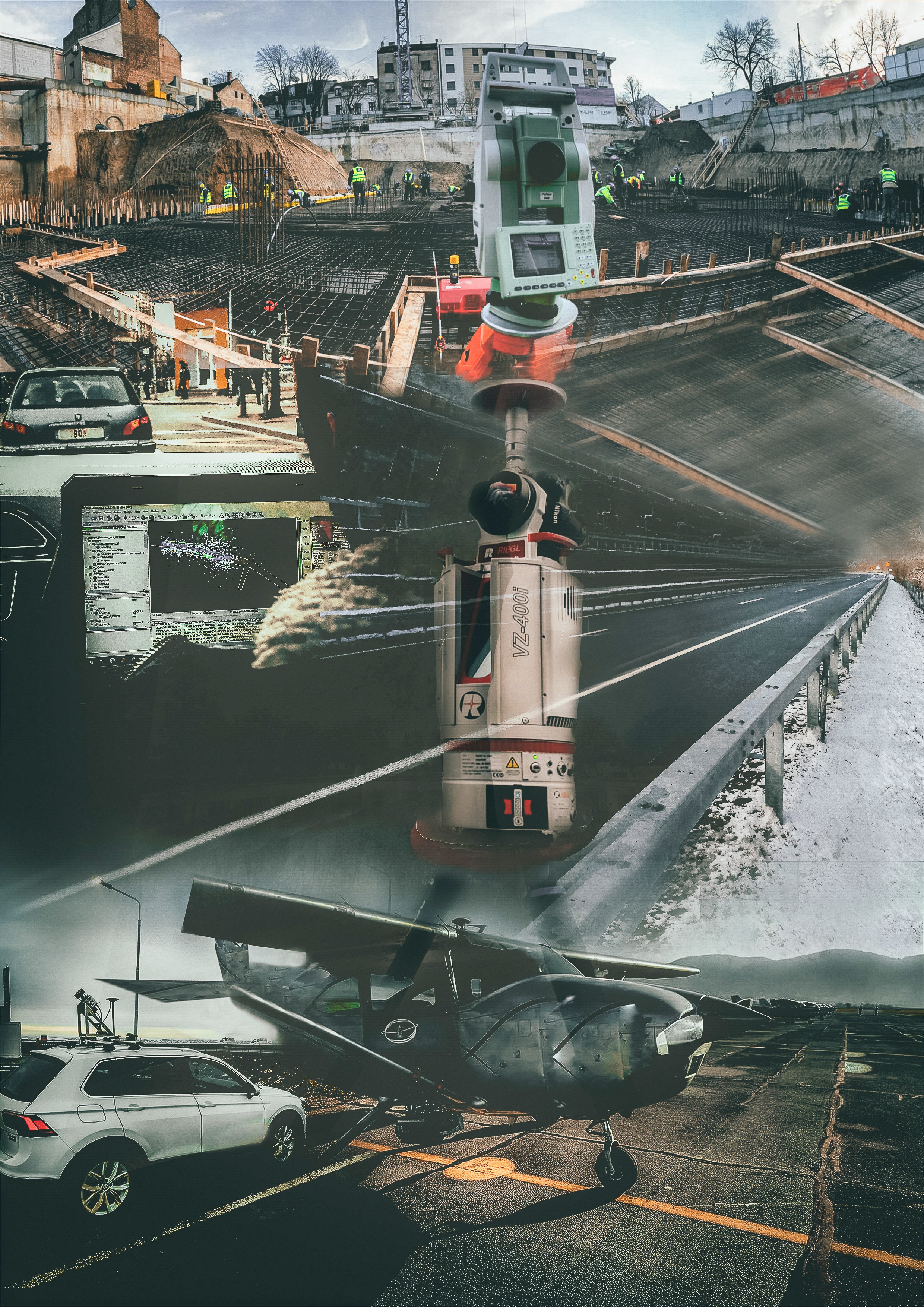
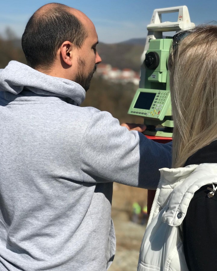
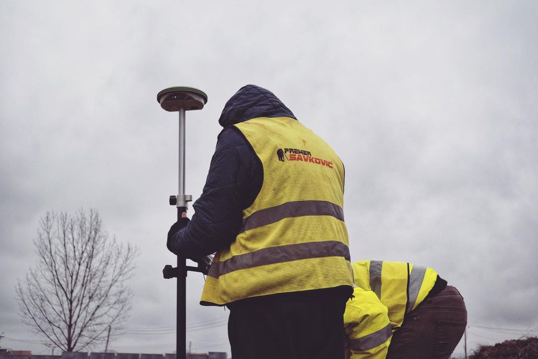
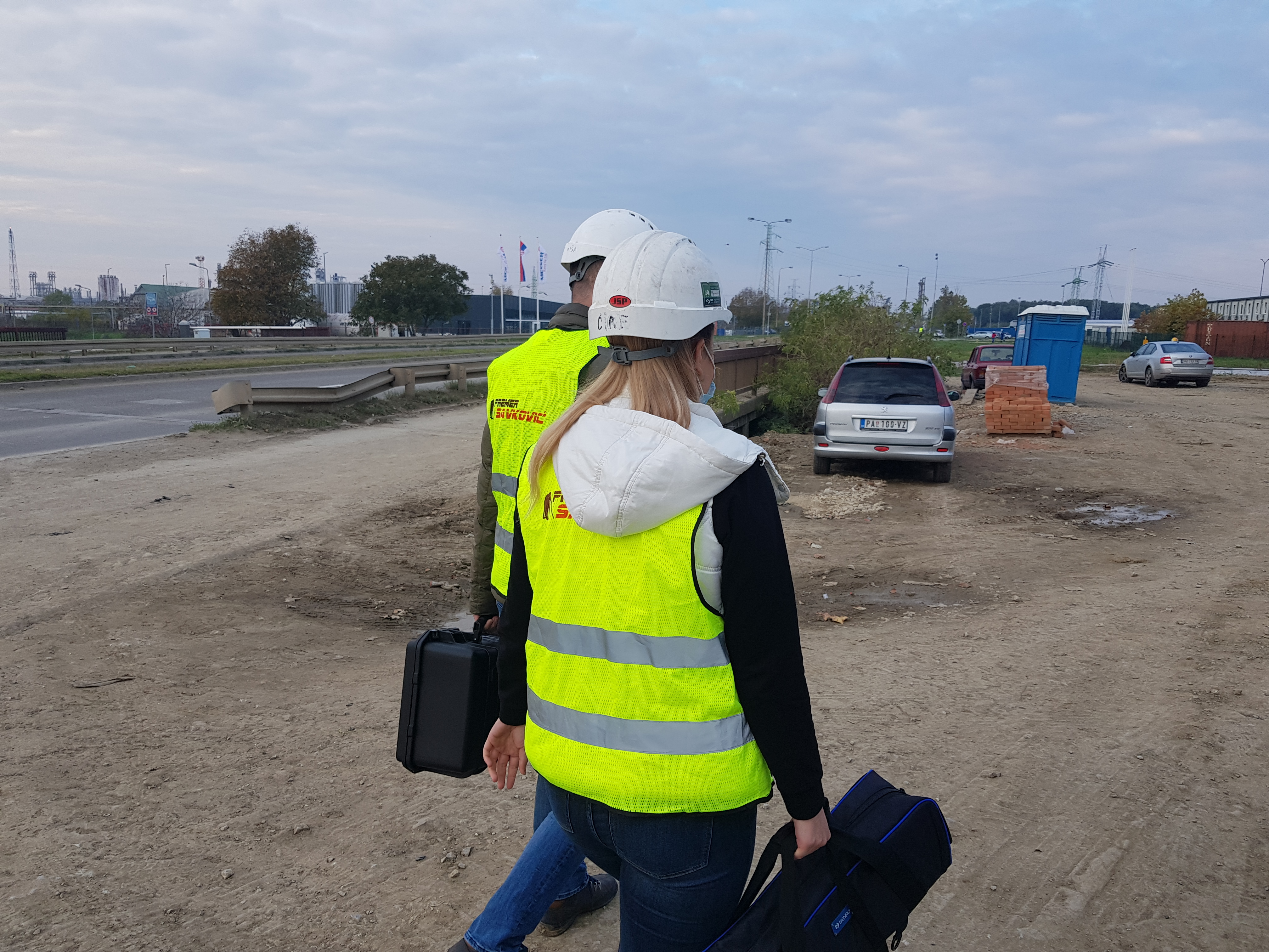
Expert team Premer Savković is capable of doing any type of geodetic work and is especially specialized in topographic surveys, surveys of underground and overhead lines, all types of cadastral geodesy, engineering auscultation projects, geodetic marking projects as well as geodetic works in low and high construction . We have modern geodetic measuring instruments, office space, software and vehicles.
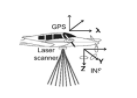
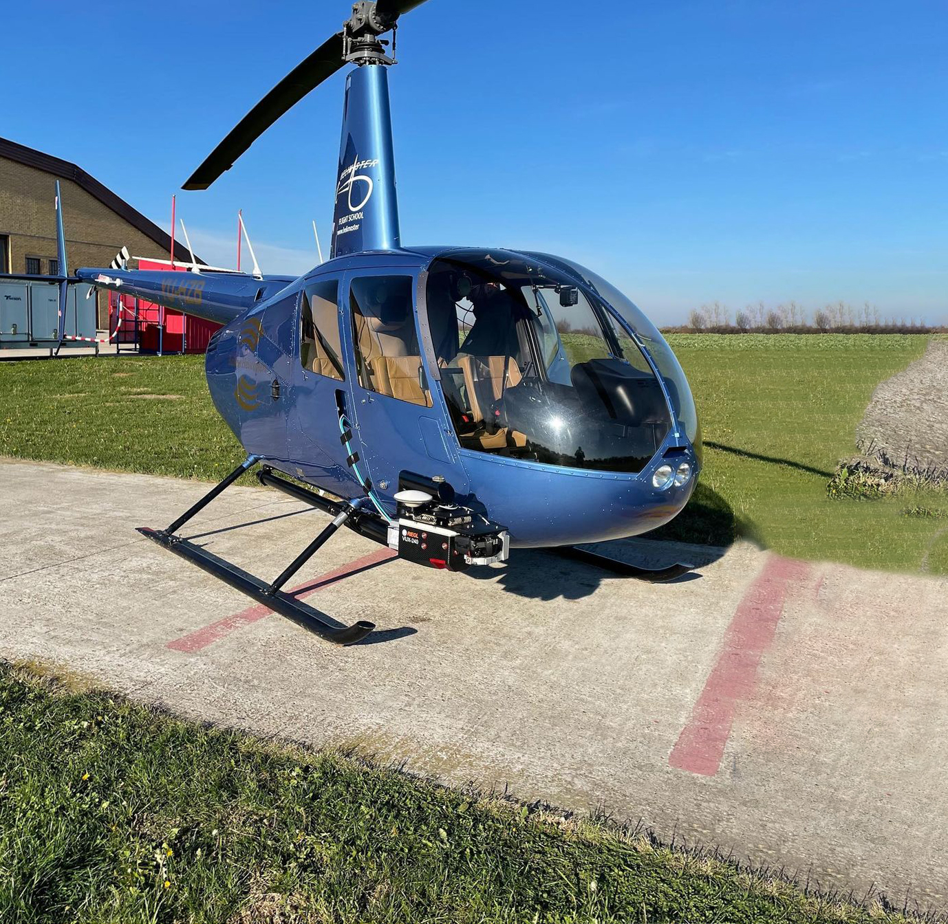
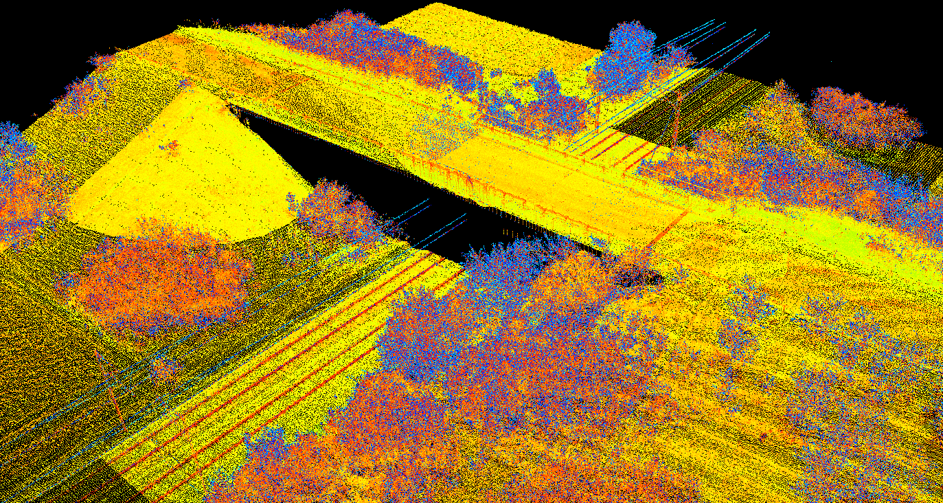
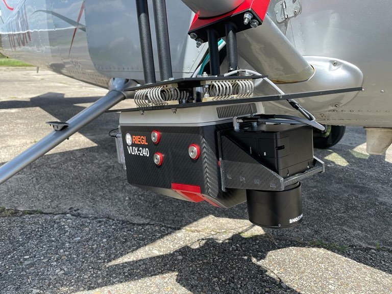
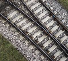
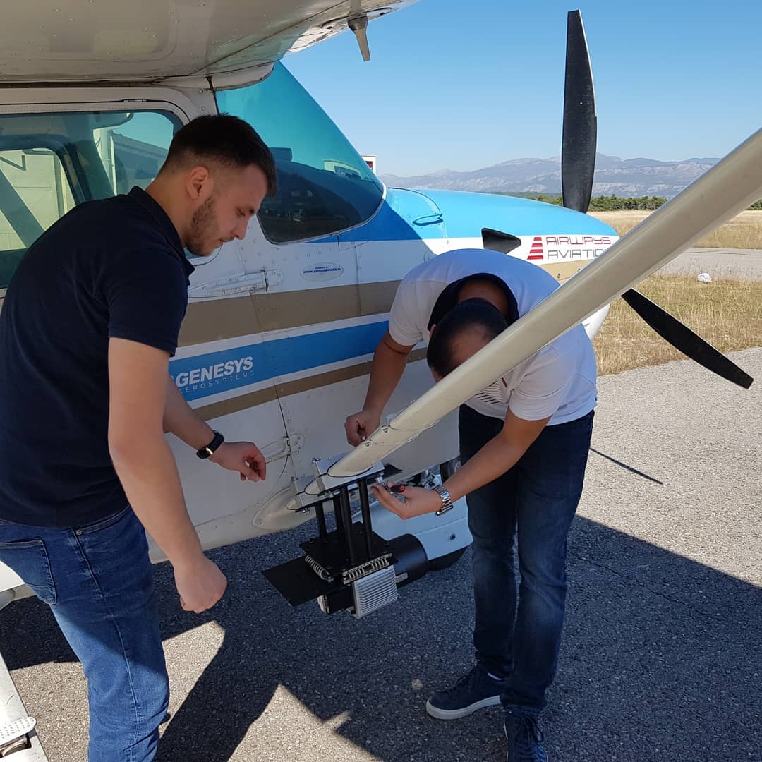
Lidar
Our LIDAR system can be adapted for scanning from an airplane or vehicle and according to that we are ful- ly prepared to meet all the needs and requirements of our clients.

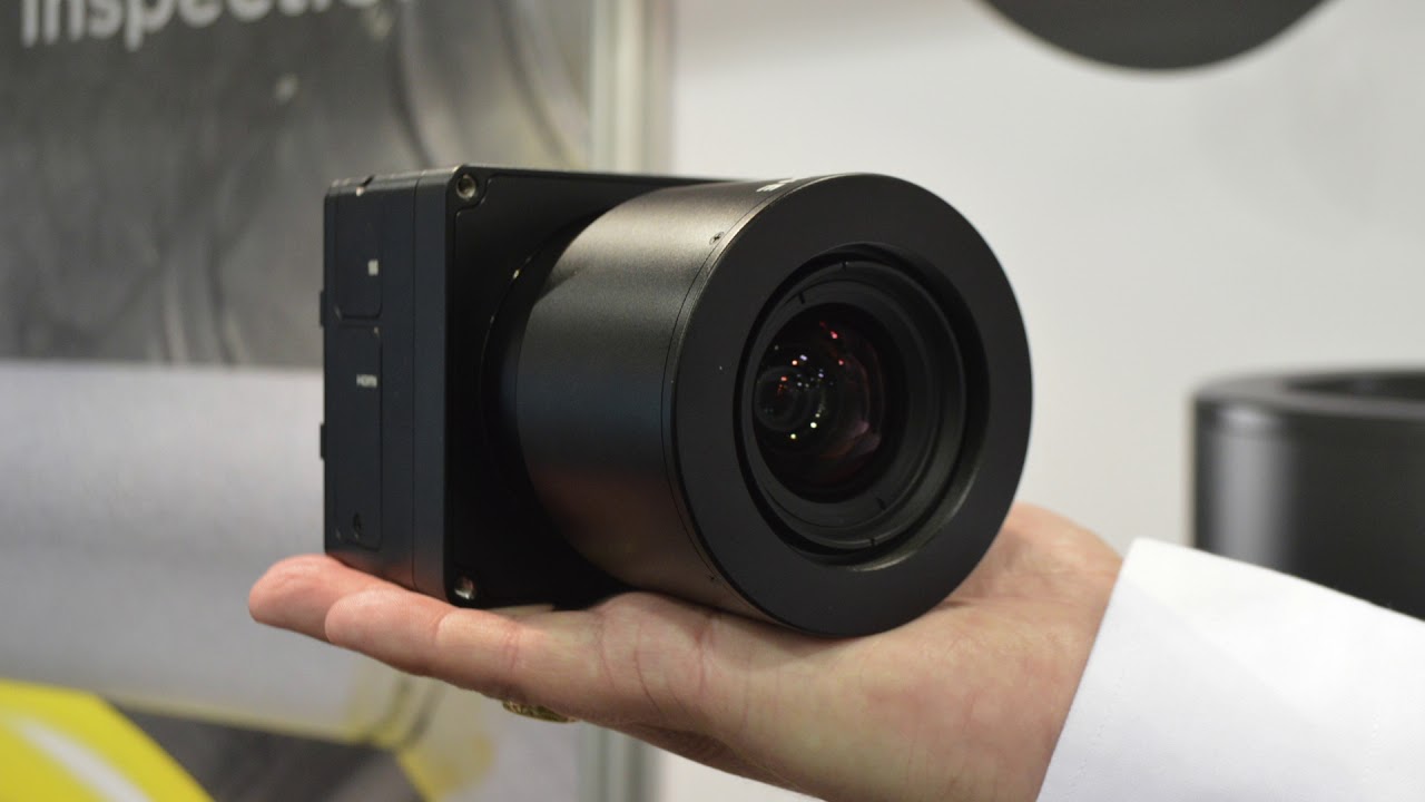
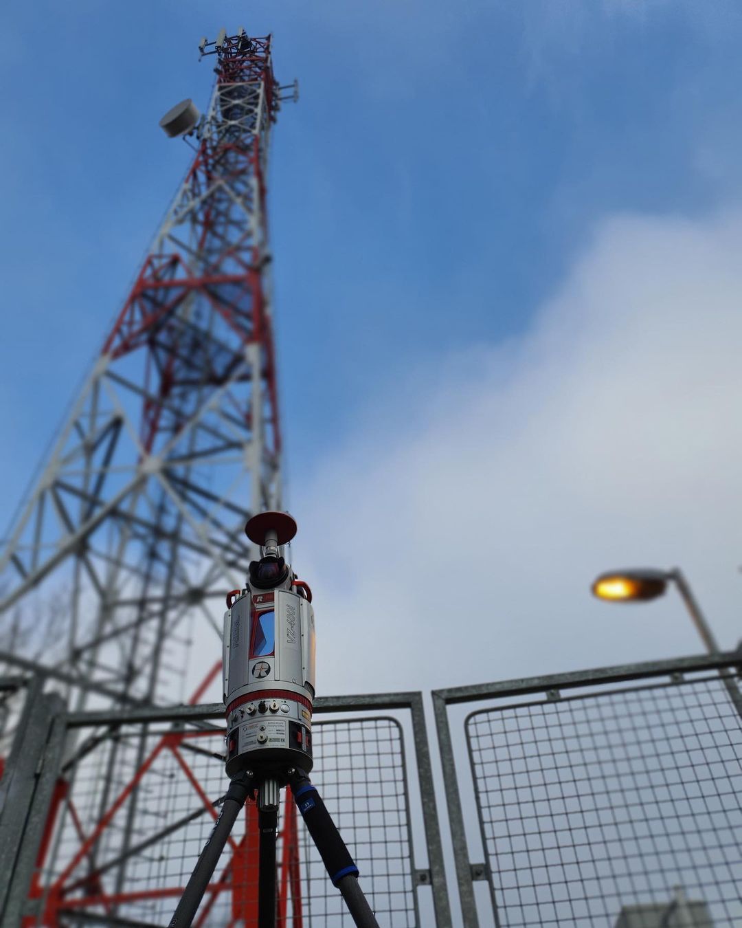
Scanner
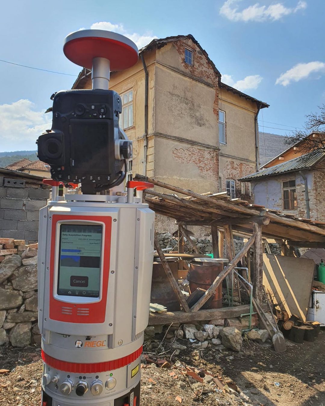
The terrestrial scanner provides detailed and highly accurate 3D data quickly and efficiently. There are a wide range of applications.
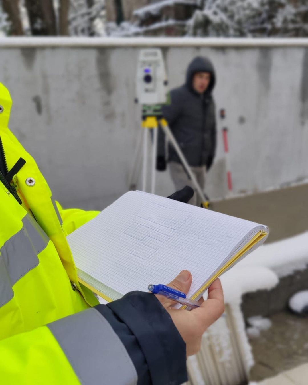
Engineering geodesy
Successful exploitation of buildings is not possible if the designed geometry within the given toleranc- es is not achieved for them.

Project documentation
Successful exploitation of buildings is not possible if the designed geometry within the given toleranc- es is not achieved for them.
Lidar
AVIO LIDAR
Albania
The aircraft lidar survey was performed in order to create a topographic plan for the projecting of the transmission line.
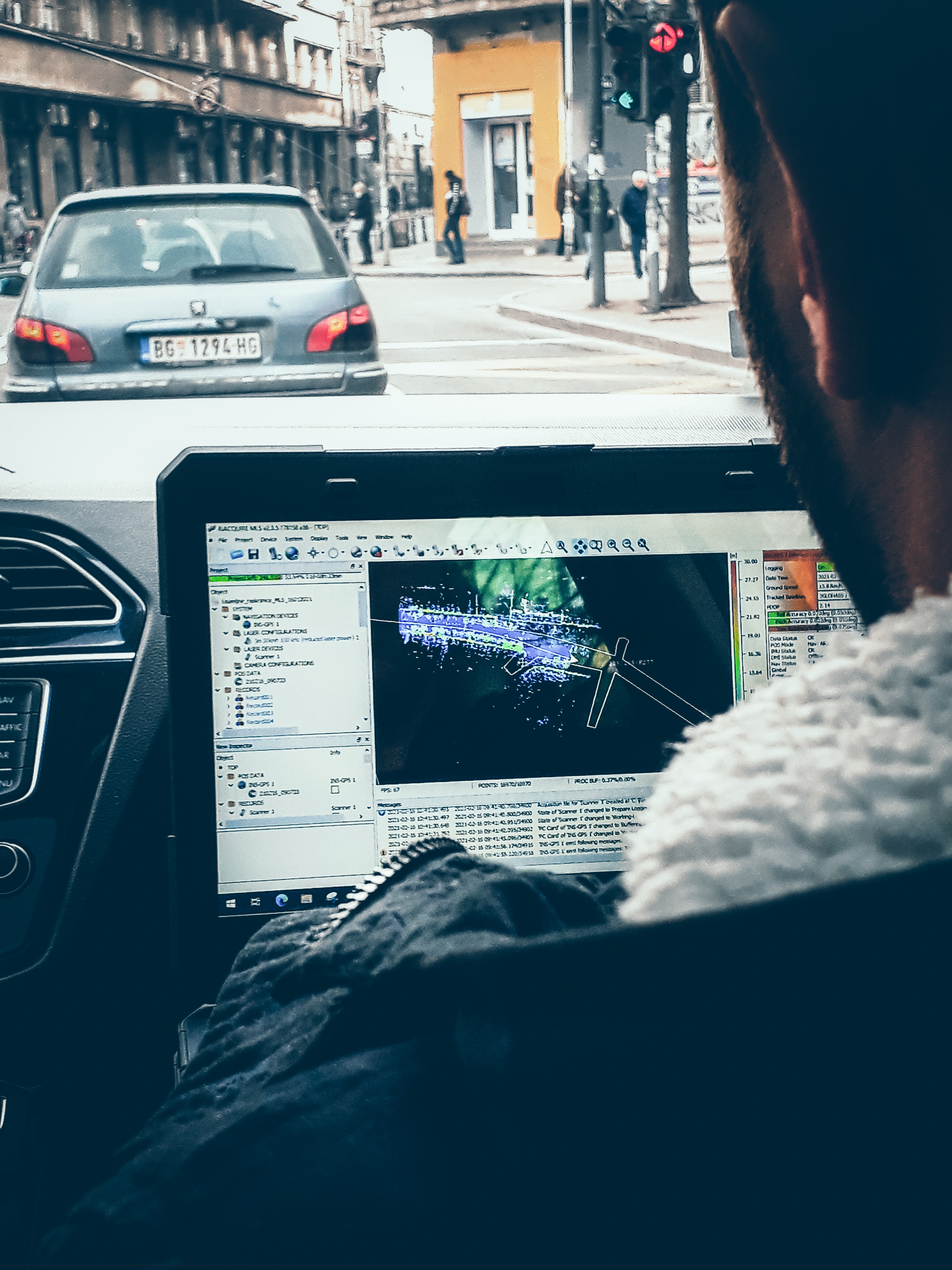
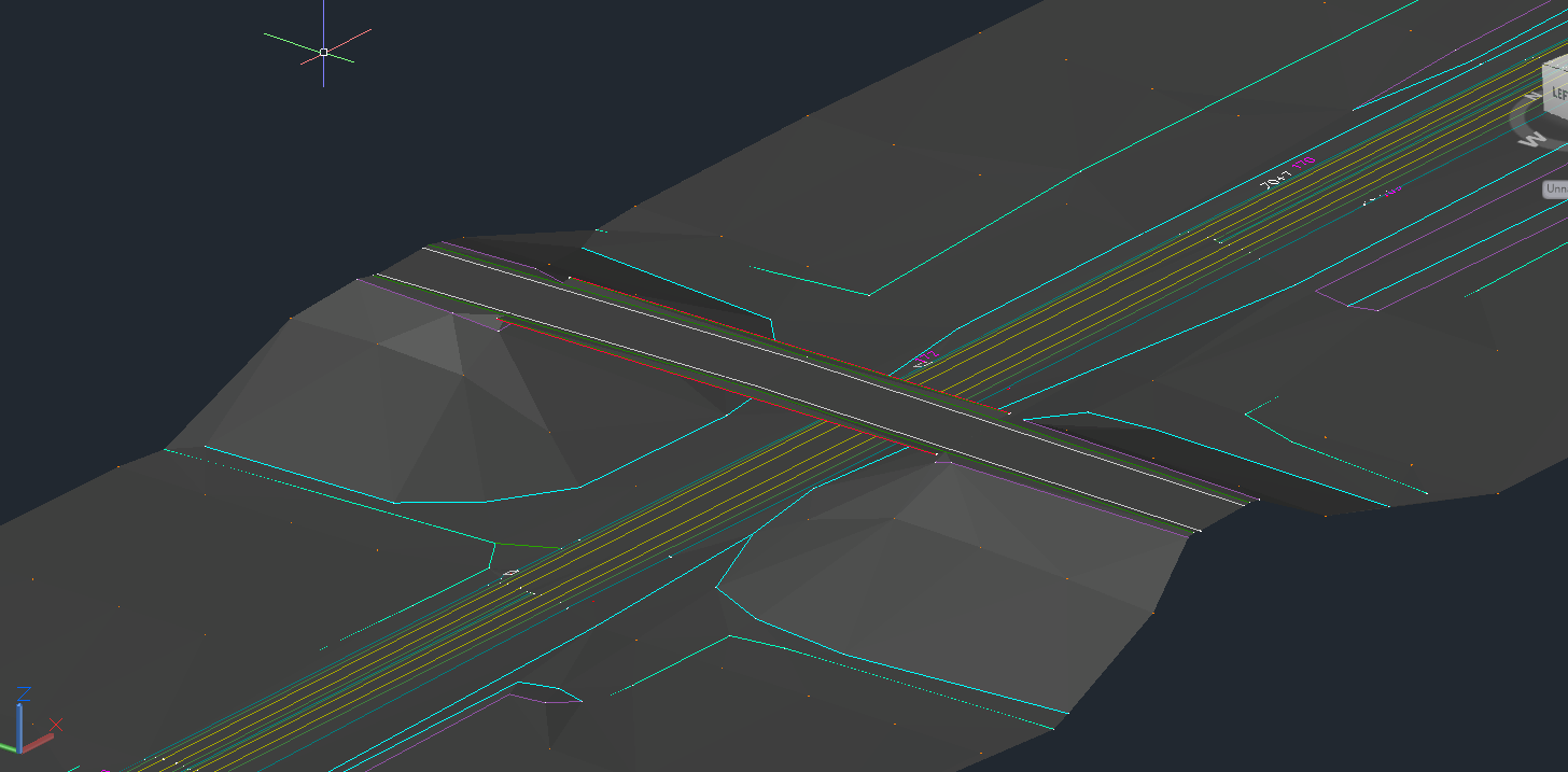
MOBILE MAPPING
Belgrade
With this project, CAD documentation of complete traffic signals of the busy streets of Belgrade was made.
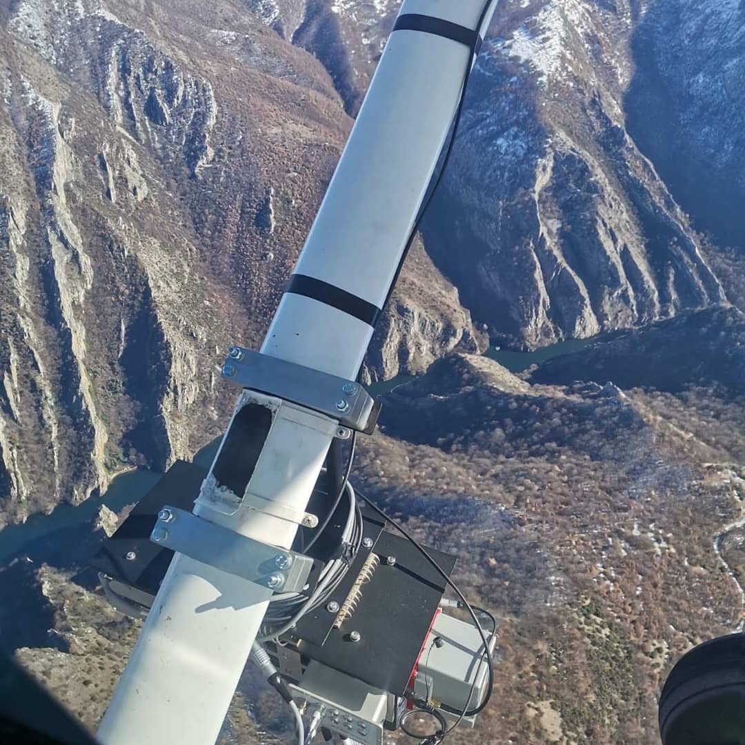
HELICOPTER LIDAR
Inđija-Šid
The project carried out a lidar survey of the Inđija-Šid railway in order to create a basis for reconstruction.
Are you looking for medium and large imagery with the highest accuracy and reliability?
Premer Savkovic combines a point cloud and photographs in order to offer his clients a whole range of product's such as powerline inspection, 3D city models with textures, high-resolution ortophotos and more.
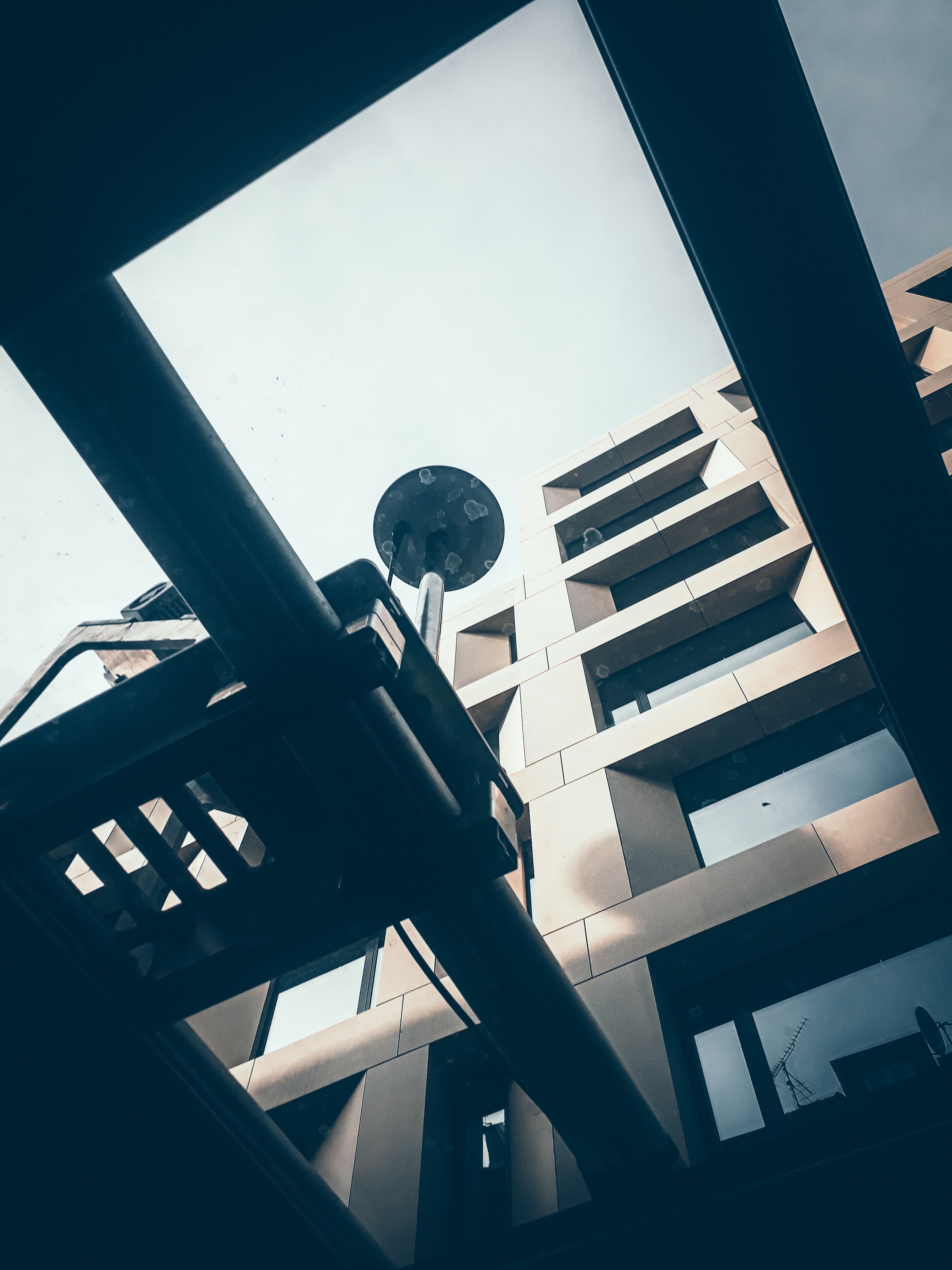
Scanner
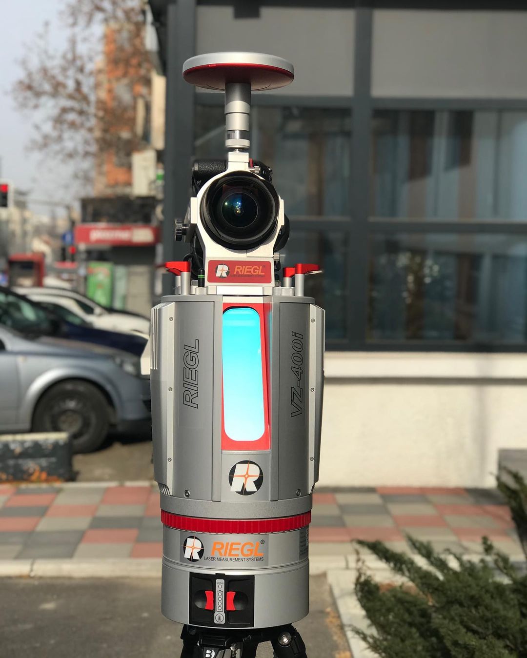
The latest generation equipment we possess
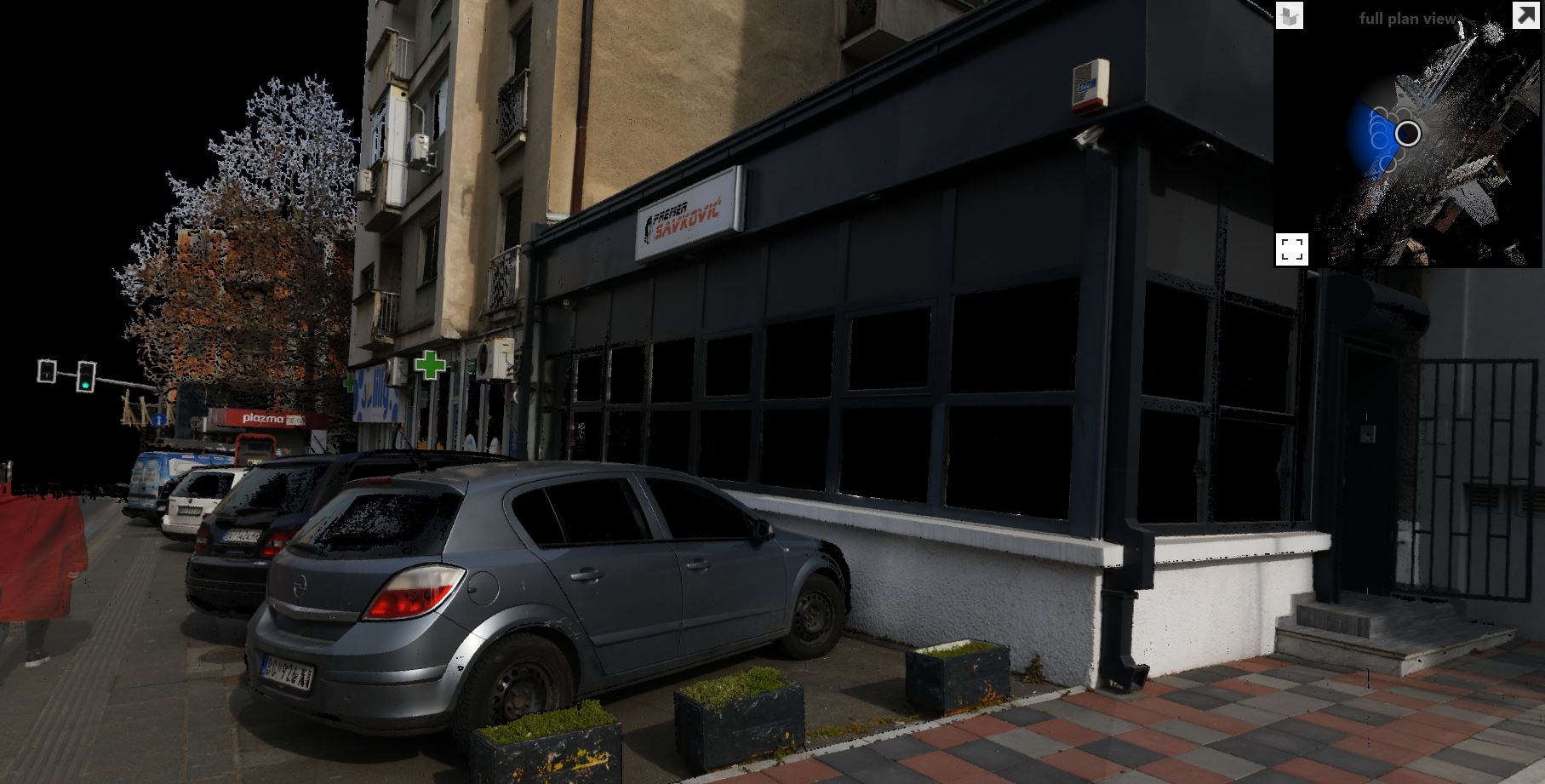
We do not want to doubt the quality of our services. That is why we have a scanner of the latest generation that allows us to generate 3D images of facades, buildings, streets etc. The picture shows an example of 3D images of our office and the where the smallest details can be seen as well as high spatial precision. This certainly allows us to solve various engineering challenges and meet all the criteria of our clients.
Terrestrial imaging of transmission line poles in Begaljica
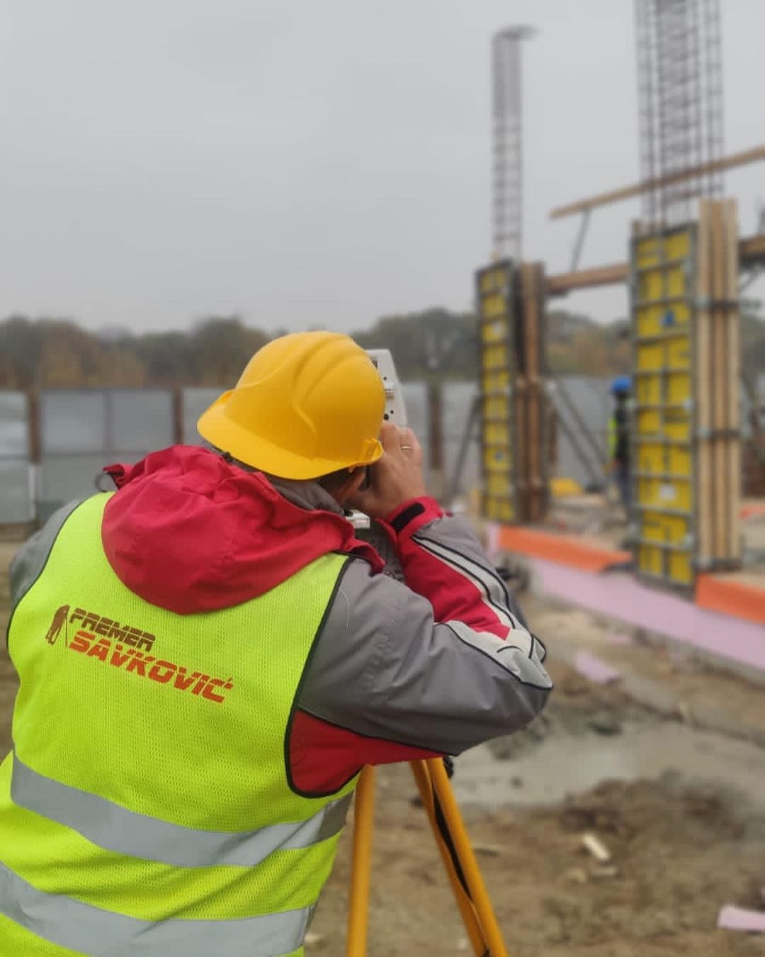
Engineering geodesy
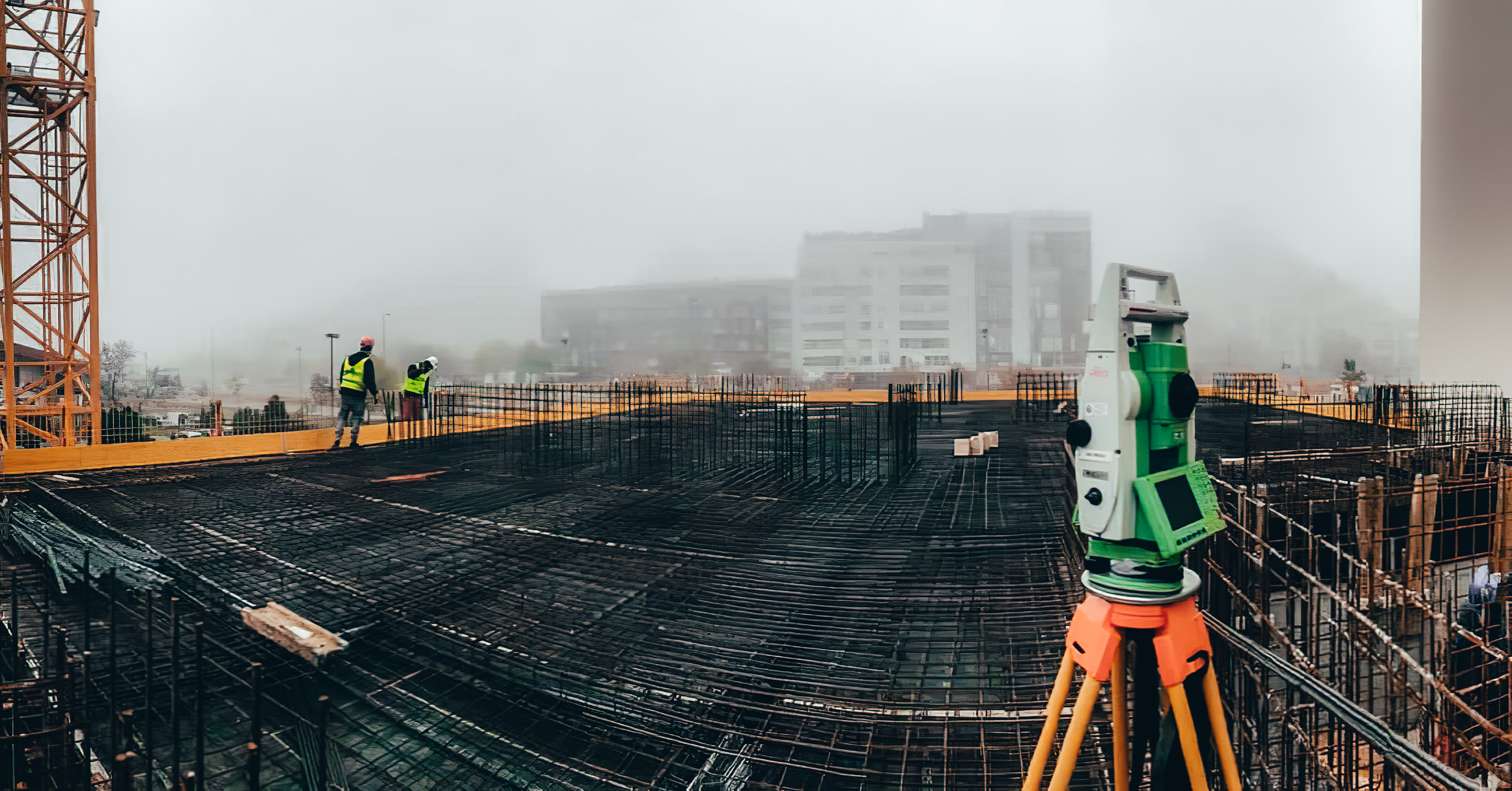
GEODETIC CONTROL OF THE SUBSTRUCTION
After the construction of the substruction of the building, the engineering team controls the substruction, makes a geodetic survey and a record. After this, we are sure that everything is on construction line.
AUTO CENTER "STOJANOVIĆ", BELGRADE
On this project, our team monitored the execution of works during the construction of the facility. In particular, the pillars are marked on the field and the position was controlled.
SURVEYING OF UNDERGROUND INSTALLATIONS
This procedure is necessary when the building is not registered in the real estate cadastre, and the owner wants to obtain a use permit, to register the ownership, to carry out the legalization procedure or the procedure of proving the ownership.
Project documentation
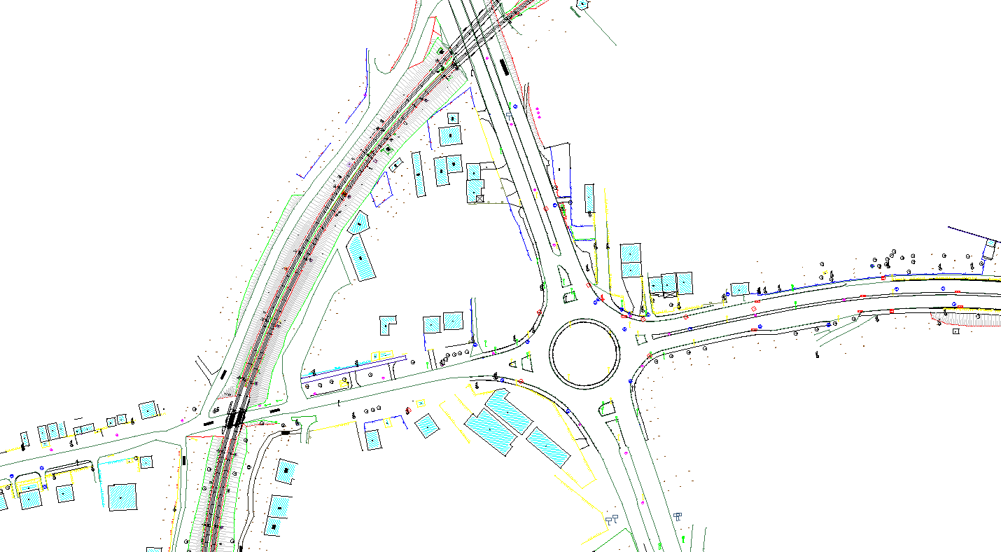
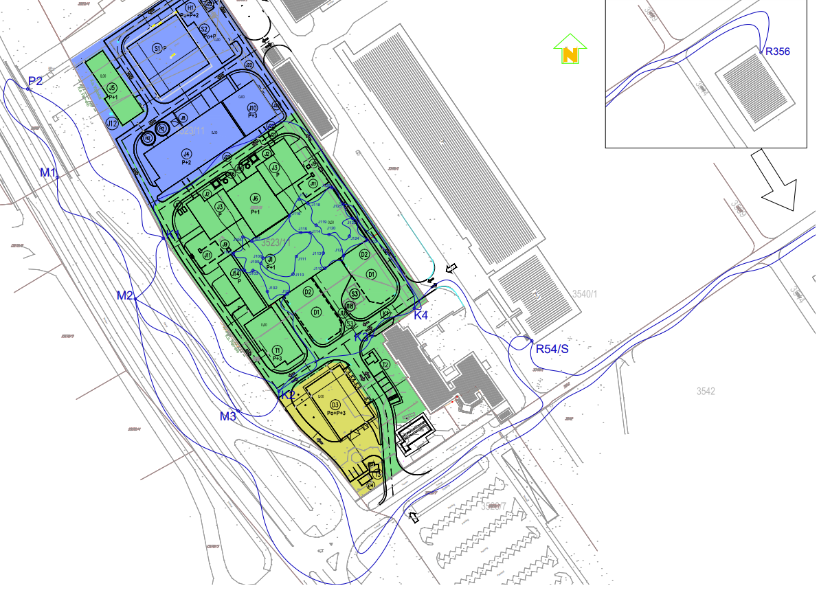
Reconstruction and modernization of the railway section Niš-Brestovac
Geodetic network projects and geodetic marking project represent the basis of all geodetic works within one construction site. In order to ensure quality transfer of the project to the field, this procedure gives the investor security, reduction of costs due to avoided extraordinary works and acceleration of the construction process due to the definition of all geodetic activities within the construction.
Project of geodetic observation of the building and soil of the Pančevo Thermal Power Plant and Heating Plant
Soil and facility settlement projects, in addition to the legal obligation, insure investors against potential unforeseen critical situations and provide continuous insight into the behavior of soil and facilities during construction. This information provides a better insight into the situation on the construction site and the possibility of timely decisions that can contribute to financial savings or prevent catastrophic consequences.
„A SATISFIED CUSTOMER IS THE BEST BUSINESS STRATEGY OF ALL”
Why our company?
Expertise and dedication
Among other things, we single out the fact that our company is made up of ambitious and professional people who are ready to maximum dedicate themselves in order to solve every engineering problem.
Optimal solutions
We strive to always provide our clients with the most optimal solution that would meet all the limitations and requirements of the project.
Efficiency
We take care to minimize the costs of our clients while efficiently implementing the project within adequate deadlines..
Our experience
The experience of almost two decades gives us confidence and security in performing the work.
As the years went by, we realized that experience in geodesy was one of the most important things. Various engineering challenges have made our knowledge and mastery in the methods of geodetic measurements, but also the knowledge of the instruments themselves, be at a very professional level.
Today’s level of development of our company has enabled us to fully understand your needs and engineering problems. In this regard, the system of our business always provides all clients with good communication and cooperation.


Gallery
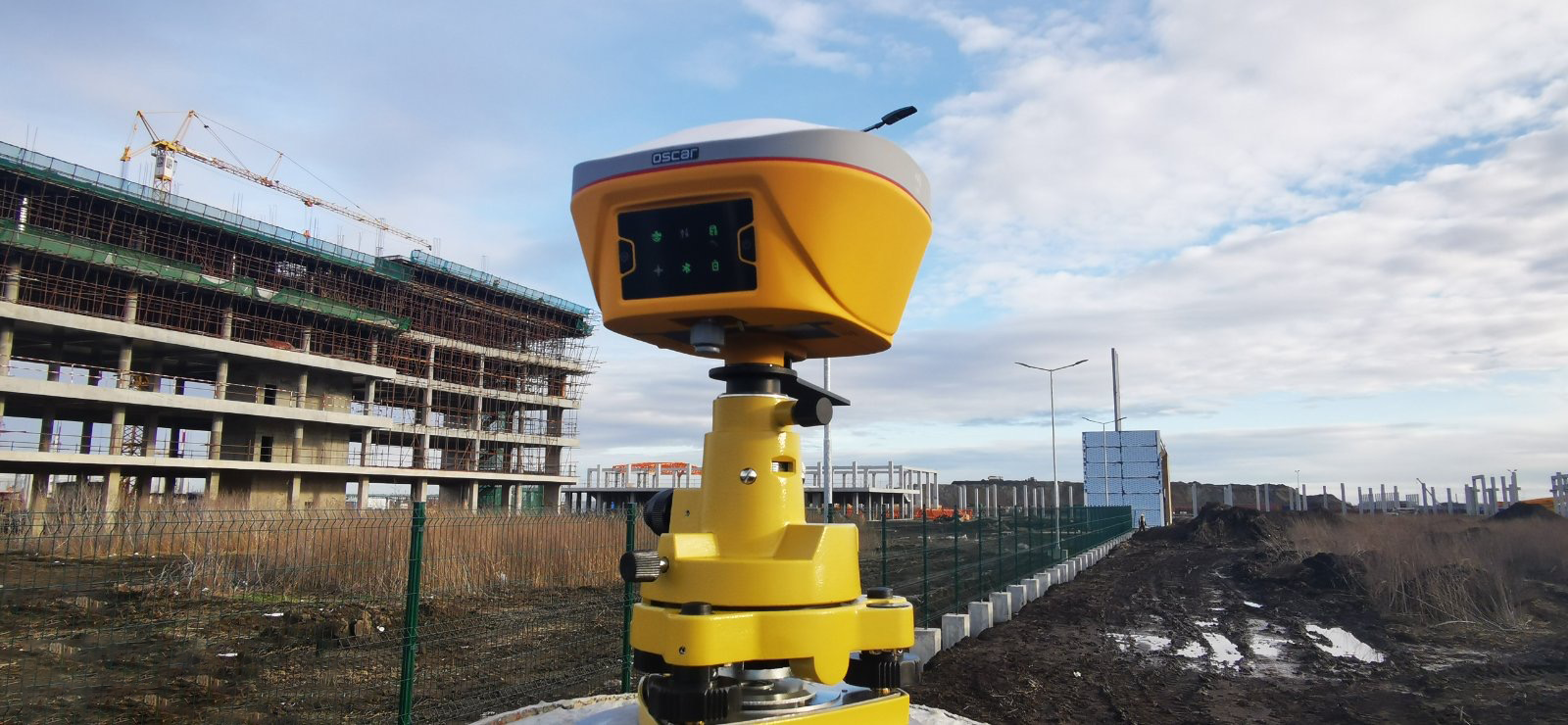
Static method of recording, Zrenjanin.
Recording of underground instalation, Belgrade
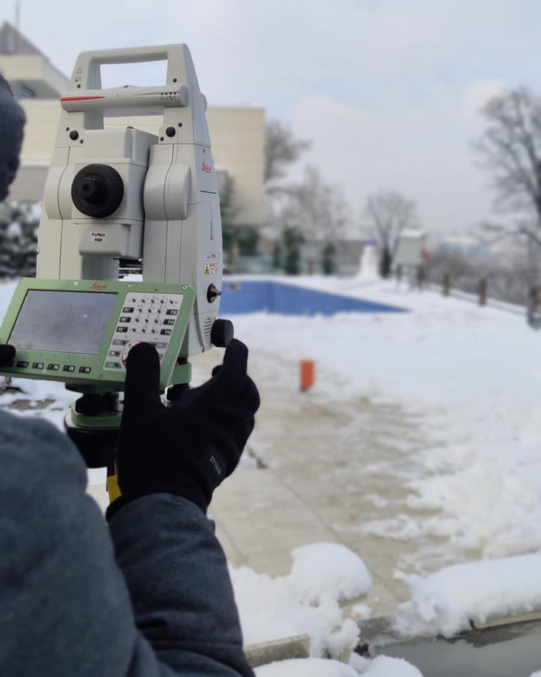
Terrestrial recording in Dimitrovgrad.
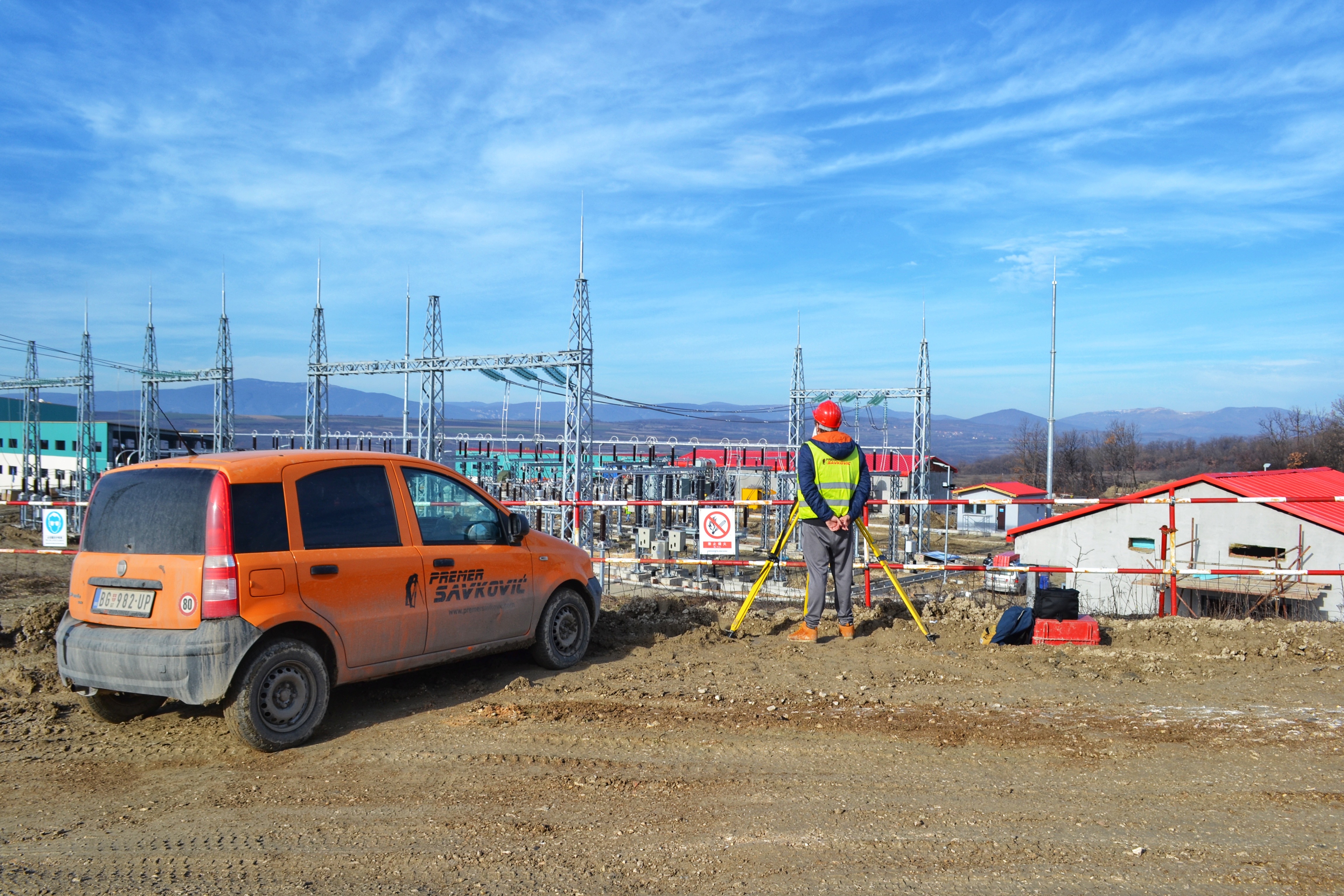
Our construction site in Bor.
Contact
Contact us in on of the following ways
Our address
11010 Belgrade Vojvode Stepe 51/Lokal 1
a
Send us an Email
kancelarija@premersavkovic.com
a
Call us
Mobile: 064/15-75-940
Faks: 011/40-90-149